Transfer information for Beykoz
What to know about Beykoz before you set off: what the area is like, the road from the airport, how long the drive takes and when the traffic builds up.
About the area
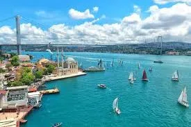
Beykoz stretches from the Asian shore of the Bosphorus to the Black Sea and, with its forests, villages and shoreline quarters, is one of the greenest districts in the city. The nineteenth-century Küçüksu Pavilion on the water and Paşabahçe's long tradition of glassmaking are among the symbols of its history. From Riva on the Black Sea coast to the fish restaurants on the Bosphorus, it appeals to those who want a stay close to nature.
Roads, drive times and peak hours
Avoiding the city centre, the car crosses the Bosphorus on one of the northern bridges and then heads down through forest roads and towards the shore to the address in Beykoz. The 46 km drive takes about 48 minutes in normal traffic. Most of the journey is on the motorway without entering the city, though the motorway junctions can still slow down on weekdays between 07:30–09:30 and 17:30–19:30 and on Friday evenings. Mobile signal can be weak in the villages of the north and at places inside the forest, so settle the meeting point and time before you set off.
The distance and drive time come from the same route data as the price on this page and assume normal traffic; how busy the roads are depends on the season, the day and the hour. Last checked: