Transfer information for Arnavutkoy
What to know about Arnavutkoy before you set off: what the area is like, the road from the airport, how long the drive takes and when the traffic builds up.
About the area
Arnavutköy, the district that is home to Istanbul Airport, lies in the city's northwest and is made up of wide farmland, villages and fast-growing new settlements. Since the airport opened, business hotels, logistics facilities and housing projects have multiplied in the district centre and along the main roads. It is a convenient location for staying close to your flight, holding meetings around the airport or visiting family.
Roads, drive times and peak hours
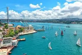
The car heads north on the Kuzey Marmara motorway, crosses the Bosphorus on the Yavuz Sultan Selim Bridge and follows the motorway west down to Arnavutköy. The 78 km drive takes about 82 minutes in normal traffic. Most of the journey is on the motorway without entering the city, though the motorway junctions can still slow down on weekdays between 07:30–09:30 and 17:30–19:30 and on Friday evenings. Even though the road from the district centre to the airport is short, for early flights don't set your pick-up time by the driving time alone; allow for the security check at the terminal entrance and the check-in queues.
The distance and drive time come from the same route data as the price on this page and assume normal traffic; how busy the roads are depends on the season, the day and the hour. Last checked: